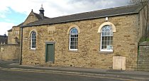
I’m not a great photographer, but I noticed this view of ‘contrails’ over Albert Road Tram-sheds the evening before Heeley Festival. I don’t often notice ‘contrails’ (short for ‘condensation trails’ or also known as ‘vapour trails’), but these lasted so long that they all start to criss-cross. I wondered what it meant for the weather at Heeley Festival the next day. According to an article in Scientific American:
‘A thin, short-lived contrail indicates low-humidity air at high altitude, a sign of fair weather, whereas a thick, long-lasting contrail reflects humid air at high altitudes and can be an early indicator of a storm.’
Well, thankfully there was no storm, but it was pretty fresh out there on Saturday.
If you’re interested in finding out more about ‘contrails’, they’re mentioned in a couple of Met Office documents: Factsheet1 on Clouds (basic information – good homework source); and ‘Science: driving our response to climate change‘ (bit more technical!).
I thought the photo was striking enough to share so I’ve added it to the Meersbrook & Heeley group pool of photographs on Flickr. There’s a permanent link to this group’s collection of photos if you scroll down the green panel to the right of Heeley Online’s main page. If you get a Flickr account, or have one already, you can join the group and add your own pictures. If you’re happy for other people to use your photos, you can give them a ‘Creative Commons’ licence. Flickr explain the different aspects of Creative Commons licences fairly simply here.


Posted on June 23, 2010 by yard-hen
0